Verified

Cuba Assessment

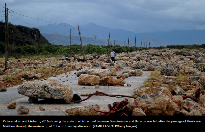
17:38 Oct 6 2016 Road between Guantanamo and Baracoa, Cuba

Cuba Assessment
Description
Picture taken on October 5, 2016 showing the state in which a road between Guantanamo and Baracoa was left after the passage of Hurricane Matthew through the eastern tip of Cuba on the afternoon of Oct 4, 2016
Credibility: UP DOWN 0
Leave a Comment
Name:
Email:
Comments:
Security Code:
13 + 10 =

Additional Reports

Cuba Assessment

17:17 Oct 06, 2016

Baracoa, Cuba, 1.38 Kms

Cuba Assessment

18:03 Oct 06, 2016

Guantanamo, Cuba, 48.41 Kms

Bahamas Assessment

11:41 Oct 05, 2016

Inagua, The Bahamas, 90.69 Kms

Haiti Assessment

17:19 Oct 03, 2016

Dame Marie, Haiti, 122.32 Kms

Haiti Assessment

10:32 Oct 05, 2016

Pointe Sable, Haiti, 127.45 Kms